Malga Ciapela: A peaceful trail with views of Marmolada
Route parameters
Length: 22.3 km
Elevation gain: 1 637 m
Terrain difficulty: moderately difficult
Malga Ciapela is a small village at the foot of Marmolada, the highest mountain in the Dolomites. In summer, it serves as a starting point for many hiking trails and via ferratas, while in winter it turns into a ski resort. If you are looking for a quieter alternative to the most famous Dolomite hikes, Malga Ciapela Marmolada offers surprisingly secluded trails with minimal crowds.
We discovered a full-day trail here where we were almost alone. We enjoyed the views of the Marmolada massif and the surrounding three-thousand-meter peaks without the crowds. This hike is more physically demanding, but every climb is rewarded with beautiful views.
If you are looking for a combination of peace, challenging terrain, and an authentic alpine experience, Malga Ciapela is a great choice.
ROUTE DESCIPTION:
The route starts at Camping Malga Ciapela and gradually descends into the quieter parts of the mountains below the Marmolada massif. The initial section is gentle, but as time goes on, the elevation gain and difficulty of the terrain increase.
After the first four kilometers, you will come across the first hut, Malga Omretta, where we recommend trying the local dairy products made from milk from cows grazing in the surrounding area. Between here and Rifugio Falier is the geographical center of the Dolomites, marked by a wooden statue with a stone heart.
We originally wanted to continue via Rifugio Falier towards Pas de Ombreta, but due to the exposed terrain, we chose a safer option and turned back at the Falier hut.
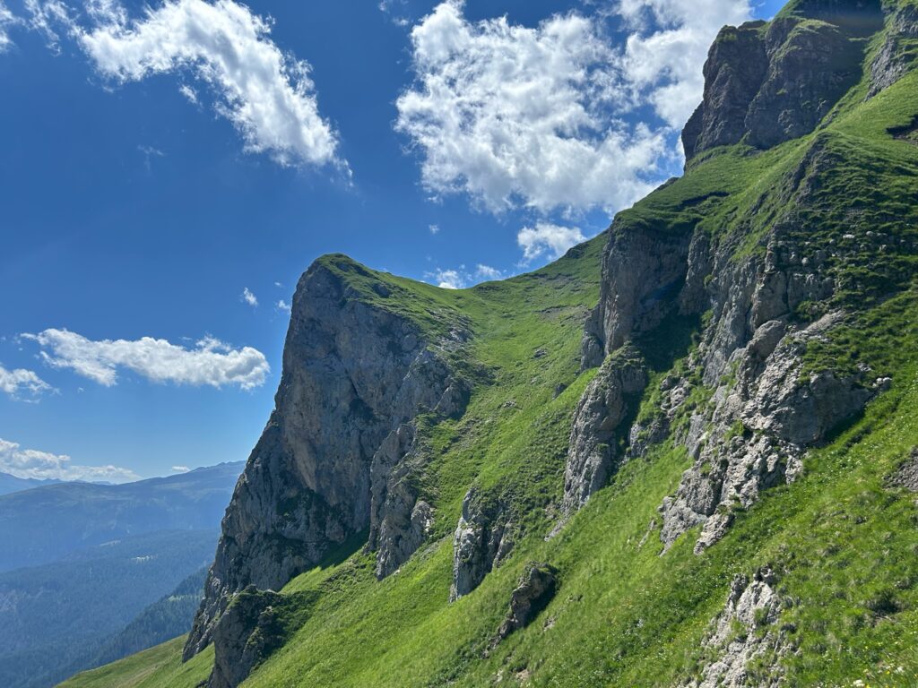
The section towards Forcella di Franedas is exposed in places, and the final ascent to the saddle is secured with ropes, which are only for support. Technically, it is nothing extreme, but sure footing and sturdy shoes are important here.
The next section between Forcella di Franzedas and Forcella Franzei is less well marked, so I recommend downloading offline maps. There are several via ferratas in the area, and a wrong turn could take you somewhere other than where you planned to go.
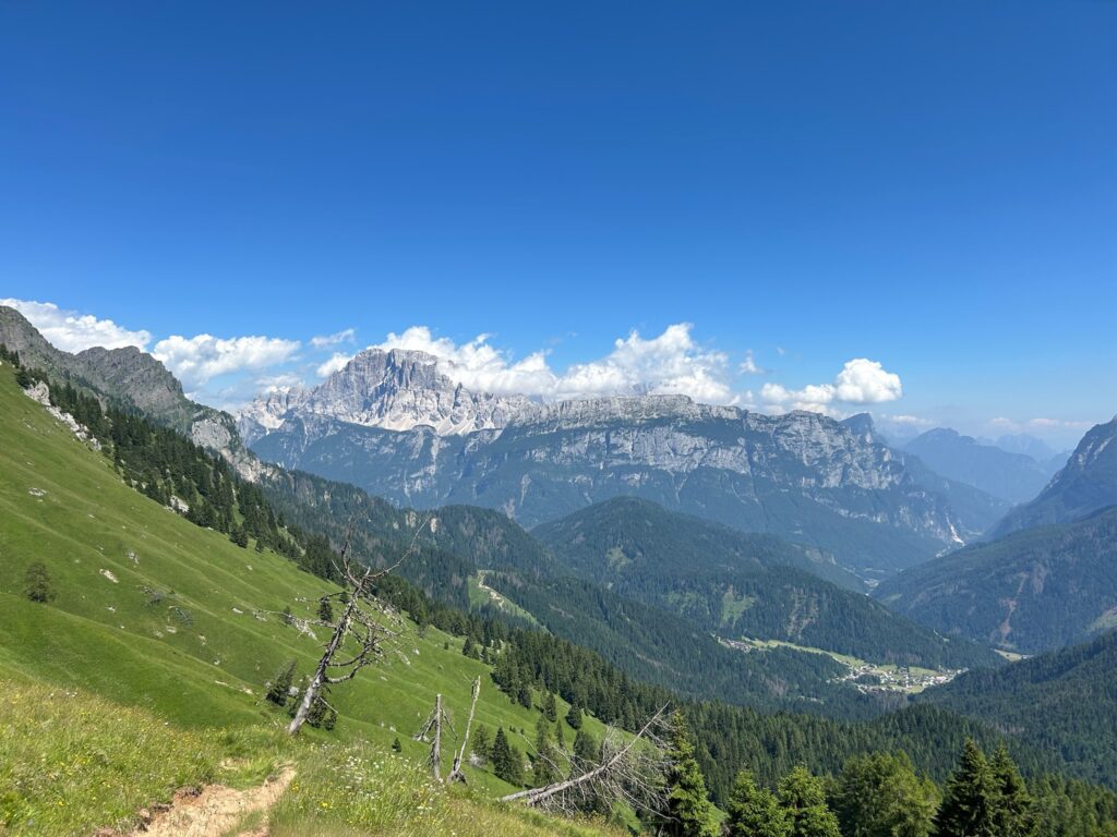
From Forcella Franzei, the route leads around Lago dei Negher o di Giai, which is an ideal place for a lunch break. This is followed by a steeper descent and then the final ascent to Forcella Pianezze.
The final descent is one of the most physically demanding parts of the entire hike. It is long and steep, but in good weather, you will be rewarded with views of the south face of Marmolada and the surrounding three-thousand-meter peaks.
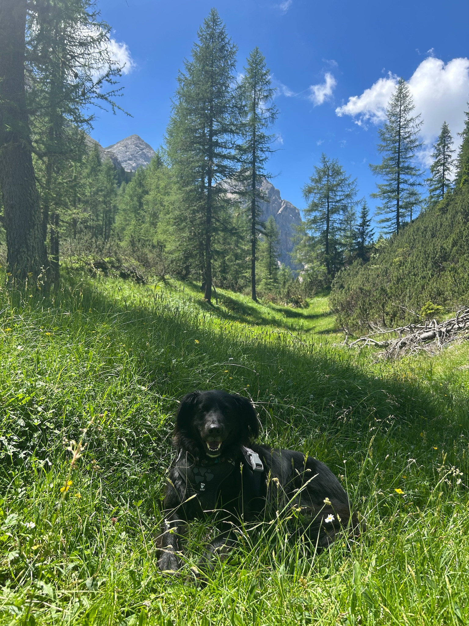
Malga Ciapela with a dog
There is one technical section and several exposed sections on the route, so it may not be suitable for every dog. However, if your four-legged friend is used to spending all day in the mountains and has experience with rocky terrain, they will be able to handle this route.
Water is a big problem. Water supplies are very limited along the route, practically impossible to find. I recommend having at least three liters of water for yourself plus enough water for your dog. We have found a 3-liter hydration pack to be useful for these all-day hikes, as you don’t have to stop to drink and usually don’t have to refill the pack during the trip.
Practical tips
Navigation: Downloaded offline maps – part of the route is poorly marked and there are via ferratas in the area that you don’t want to get to without equipment.
Equipment: In addition to sturdy shoes, poles are almost a necessity. They will help you on steep climbs and during the challenging final descent. Given the open terrain, I also recommend a light waterproof jacket, as the weather under Marmolada can change quickly.
Water sources: After passing Malga Ombretta, there are no more huts on the route. The only natural source of water is several kilometers from the last hut, and then there is nothing for the rest of the day. Plan your supplies in advance.
Food: If you want to make your hike more enjoyable, plan to have breakfast at Malga Ombretta. Homemade yogurt with a view of Marmolada is an experience in itself.
Summary
The Malga Ciapela is a long and demanding trail, but every climb rewards you with views of Marmolada, Cima Ombretta, and other three-thousand-meter peaks in the area. The biggest bonus is the peace and quiet. We only encountered two or three groups of people during the whole day, which is truly exceptional in the Dolomites.
If you are looking for a less frequented hike in the Malga Ciapela Marmolada area that combines physical challenge, solitude, and views of the highest mountain in the Dolomites, this route will not disappoint you.
Newsletter
Signup for news and special offers!
Thank you!
You have successfully joined our subscriber list.
Contact Us
We love connecting with people who share our passion for trails, dogs, and the outdoors.
If you’d like to collaborate, share a route, or just say hello-get in touch and let’s start the conversation.